
The quick answer

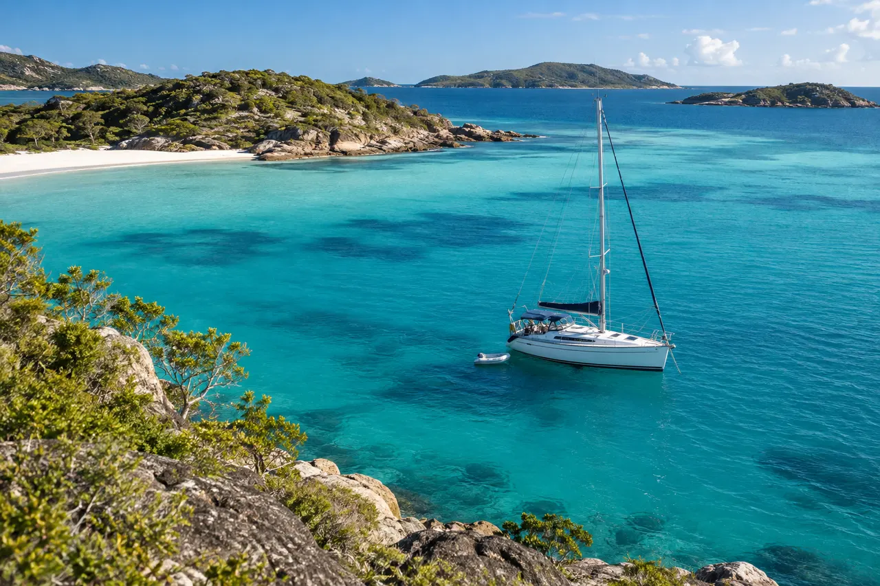
A successful Whitsundays trip combines charter-operator limits with current weather, large tidal ranges, reef awareness and conservative anchorage selection.
- Who it suits
- Skippers researching Queensland
- Before you start
- Bring your vessel, crew and route details to the planning discussion
- Time to allow
- Recheck charts, notices, forecast and local restrictions for the actual trip
- Budget beyond tuition
- Current navigation information, suitable training and flexible travel
- Your next step
- Use the linked Queensland authorities before making operational decisions
- Before relying on advice
- Check the current official source. Reading a guide does not certify practical competence or grant permission to operate.
Expanded 5 October 2026 · SkipperCourse editorial team · Illustrative exercises, not operational instructions.
Respect the operating area
Study the charter company’s permitted area, daily radio schedule, briefing material and procedures. Record no-go zones and any restrictions that change with weather, vessel type or time of day.
Great Barrier Reef Marine Park zoning and local anchoring controls protect sensitive areas. Use current official maps and public moorings where directed.
Make tide part of every leg
Large tidal ranges alter depth, current, beach access and the protection offered by some anchorages. Calculate the minimum expected depth and consider how wind against tide may affect comfort and control.
Leave margin around reefs and shoals. Electronic charts are helpful, but zoom level, datum, accuracy and human input can all mislead. Keep a visual lookout and use official information.
Choose the anchorage before you need it
Assess forecast wind direction and strength, tide, holding, swing room, reef and other boats. Have a second option that remains sensible if the first is crowded or exposed.
Arrive with daylight and enough time to verify the set. The itinerary should follow safe anchorages and conditions, not the other way around.
Build the holiday around a flexible daily decision
Start with the charter operator’s permitted area and briefing material, then identify a small set of destinations you would enjoy if conditions suit. Do not book the emotional success of the holiday against visiting every location. A destination list is a wish list until the boat, crew, forecast and current restrictions have been considered together.
For each day, allocate time to receive the operator’s updates, review conditions, prepare the boat and arrive without rushing. Ask how the company expects a changed itinerary to be reported. If you are delayed at the base or the crew needs more familiarisation, a shorter first day may be the better holiday decision as well as a better learning decision.
Moorings, anchoring controls and availability are separate checks
The Reef Authority publishes mooring and no-anchoring information, including a Whitsundays guide. Use that material alongside the operator’s requirements. Finding a mooring on a map does not establish that it suits your vessel, is available or can be used for the duration you want. Read the applicable information rather than relying on the colour or appearance of a buoy alone.
Have an alternative that is both permitted and suitable for the conditions. If the first choice is unavailable, arrival time and crew fatigue should not force a poor decision at the second. This guide does not nominate an anchorage as safe in a particular wind or provide a route through reef areas; use current authoritative information and the operator’s local briefing.
Worked scenario: a late change to the overnight stop
Illustrative example: the crew prefers a popular stop, but its availability is uncertain and the forecast no longer matches yesterday’s plan. Revisit the reasons for choosing it rather than defending the original itinerary. Ask whether an operator-approved alternative would reduce the distance, simplify the arrival and leave more time to settle before dark.
Explain the change in practical terms to the crew: what information changed, what the revised plan preserves and which sightseeing can wait. Review the tide and approach information for the new destination from the beginning; do not treat the alternative as ready merely because its name was on a list. Record tomorrow’s review time so the change becomes part of an organised plan.
Keep the decision ahead of the destination
Check
Current information, actual boat and crew capability.
Compare
Do conditions still match the plan’s assumptions?
Decide
Continue, change or postpone before options narrow.
Update
Brief the crew and communicate the revised plan.
Conceptual learning aid. Follow current official guidance and appropriate practical instruction.
Put the guide into practice
Use this worksheet to organise a discussion with your instructor or operator. Complete it for the actual boat and intended activity; it does not approve a trip.
| Prompt | What the skipper should resolve |
|---|---|
| Operator update | Current permitted area, briefing conditions, reporting arrangements and any changes affecting the boat. |
| Overnight choice | Suitability, permissions, availability, tide considerations and a genuinely usable alternative. |
| Arrival margin | Time for familiarisation, provisioning delays, a changed destination and settling before darkness. |
| Crew readiness | Who handles the briefing, navigation support and arrival tasks, and whether fatigue changes the plan. |
Working checklist
- Know charter limits and radio schedule
- Check BOM forecast and warnings daily
- Use current GBRMPA zoning information
- Calculate depth and tide for each leg
- Choose primary and backup anchorages
Questions skippers ask
Can I rely on the charter briefing alone?
No. The briefing is important, but the skipper must continue checking current forecasts, zoning, navigation information and operator updates.
Are public moorings guaranteed to be available?
No. Plan an acceptable alternative anchorage and do not circle unsafely while waiting.
Should I reserve a fixed island itinerary before chartering?
Discuss any fixed commitments with the operator. Leave enough flexibility that weather, permissions or availability can change the sailing plan without creating pressure to reach a particular stop.
Can a public mooring replace all anchoring preparation?
No. Availability and suitability must be checked, and you need a permitted alternative. Familiarise yourself with the actual boat’s ground tackle through the operator’s handover rather than assuming every night will be on a mooring.
Primary sources to check
Open these sources again when planning; linked requirements and conditions may have changed since this guide was reviewed.
GBRMPA zoning↗BOM Queensland marine↗Reef Authority: moorings and no-anchoring areas↗
Schools to investigate for your next step
YouSail-published school records, mirrored from SailingSchools. Source snapshot: 5 October 2026. Listings are not endorsements or confirmation of current courses, accreditation or available places.
Mainstay Sailing
Airlie Beach · queensland
The YouSail record places this school in Queensland. This is a state match, not proof that it teaches in the exact waters discussed.
Paper Sailors Rock
Manly · queensland
The YouSail record places this school in Queensland. This is a state match, not proof that it teaches in the exact waters discussed.
Southern Cross Yachting
Manly · queensland
The YouSail record places this school in Queensland. This is a state match, not proof that it teaches in the exact waters discussed.
Sunshine Sailing Australia
Mooloolaba · queensland
The YouSail record places this school in Queensland. This is a state match, not proof that it teaches in the exact waters discussed.
Whitsunday Sailing School
Airlie Beach · queensland
The YouSail record places this school in Queensland. This is a state match, not proof that it teaches in the exact waters discussed.
Matching records are alphabetical, not ranked.
Explore all published school records →Questions to take to your shortlist
Send the same questions to each provider and compare specific written answers.
- Your actual goal
- Which exact course fits my vessel, experience and intended use? Who should confirm its acceptance?
- Time at the controls
- How many students share the boat and instructor? How do you rotate practical roles?
- What the timetable includes
- How much time is active instruction or practice, excluding transfers, breaks and administration?
- The complete price
- Are materials, equipment, membership, assessment, certificates, meals and accommodation included?
- Changes and cancellation
- What happens if weather, illness, instructor availability or the training boat changes the plan?
- After the course
- What should I practise next, and where can I get suitable supervised experience?